
Make3DMap: Build Interactive 3D Maps from Real Places

What is Make3DMap
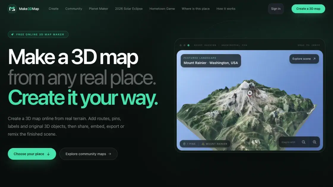
Make3DMap is a free online tool that transforms real-world locations into interactive 3D maps. Users can search any place on Earth, lift terrain into a tactile diorama, and customize the scene with routes, pins, labels, and 3D objects. The platform includes an AI map assistant that helps research locations, analyze visual references, and place recognizable objects. Scenes can be published as permanent URLs, embedded on websites, or exported as GLB or STL files for 3D printing and production pipelines.
How does Make3DMap work
Make3DMap queries real-world elevation data based on the user's selected location. The terrain is rendered as a 3D mesh that can be shaped and adjusted. An AI agent analyzes the chosen area, researches local landmarks and features, and places appropriate 3D objects. Users interact through a web interface to add routes, pins, labels, and additional elements. The final scene is stored as a shareable URL and can be exported as standard 3D file formats.
Benefits of Make3DMap
Make3DMap eliminates the need for specialized GIS software or 3D modeling skills to create geographic visualizations. The AI map assistant automates object placement and research, reducing manual work. Built-in sharing features mean scenes are immediately publishable without additional hosting setup. The free pricing removes barriers to entry, though advanced users may eventually need more control over terrain resolution and object libraries than the current tool provides.
Pros and Cons of Make3DMap
Pros
- Free with no paid tiers or usage limits
- AI assistant automates object placement and research
- Exports to standard 3D formats (GLB, STL)
- No installation required, runs in browser
- Scenes are immediately shareable via URL
Cons
- Terrain resolution and object library may be limited
- No information on offline access or mobile support
- Limited documentation on data sources and accuracy
Core Features of Make3DMap
Real-World Terrain
Make3DMap starts with actual geographic data instead of a blank canvas. Users search anywhere on Earth, frame the exact area, and lift real elevation into a tactile 3D diorama that reflects the actual landscape.
Map Agent
The built-in AI assistant researches locations, analyzes visual references, and quality-checks recognizable 3D objects before placing them in the scene. Users can describe what they want or provide reference images to guide the placement.
Shareable by Design
Every scene becomes a permanent story with a clean URL. Published maps can be embedded anywhere, and other creators can remix independent copies without affecting the original.
3D Export
Terrain and scenes export as GLB or STL files, allowing users to continue working in Blender, Unity, or Unreal Engine. This bridges the gap between web-based map creation and professional 3D production pipelines.
Use Cases of Make3DMap
- Educators: Make geography and history lessons interactive with explorable 3D terrain models
- Travelers: Document journeys with spatial labels, pins, and routes over mountains and coastlines
- Game developers: Block out terrain, landmarks, and atmosphere before moving into full 3D pipelines
- Event organizers: Publish memorable interactive maps for festivals, conferences, or destination events
- 3D printing enthusiasts: Export terrain as STL files for physical model production
FAQs of Make3DMap
What is Make3DMap?
Make3DMap is a free online tool that creates interactive 3D maps from real-world locations. It combines geographic data with AI-assisted object placement to produce shareable 3D scenes.
Who is Make3DMap for?
The tool serves educators, travelers, game developers, event organizers, and anyone who wants to visualize a real place in 3D. No technical background is required.
How much does Make3DMap cost?
Make3DMap is completely free to use. There are no paid tiers, subscriptions, or usage limits mentioned on the site.
Can I export my 3D map?
Yes. Scenes export as GLB or STL files, which work with Blender, Unity, Unreal Engine, and 3D printing software.
How does the AI map assistant work?
Users describe what they want or provide reference images. The assistant researches the location, analyzes visual references, and places recognizable 3D objects with quality checks before finalizing the scene.
Can I embed my map on another website?
Yes. Every published scene has a clean URL that can be embedded anywhere. Other creators can also remix copies of public scenes.
How to use Make3DMap
- Search for a location on Earth and frame the exact area you want to visualize
- Lift the terrain into a 3D diorama using real elevation data
- Use the map assistant to add routes, pins, labels, and 3D objects by describing what you want or providing reference images
- Adjust and refine the scene until it matches your vision
- Publish the scene to get a shareable URL, or export as GLB/STL for 3D printing and production
Make3DMap Website Traffic Analysis
Latest traffic information
- Monthly Visits1.6K
- Bounce Rate--%
- Pages Per Visit5.8
- Visit Duration00:10:36
- Global Rank7.42M
- Country/Region Ranking105.39K
Top Keywords
| Keyword | Traffic | Volume | Cost Per Click |
|---|---|---|---|
| mapas 3d crear | 90 | -- | -- |
| map3dmake | 70 | 80 | -- |
| planet maker | -- | 2.01K | -- |
| solar eclipse simulator | -- | 350 | -- |
Make3DMap Alternatives
JuJuBit turns a photo into a custom 3D-printed figurine: choose a style, preview the AI-generated model, and receive a hand-refined painted collectible.
img2threejs converts product photos and object images into editable procedural Three.js models, with named parts, JSON specs, and TypeScript downloads for web 3D projects.
Meshy generates 3D models from text prompts and images in 20-30 seconds, offering AI texturing, rigging, animation, and exports in FBX, OBJ, GLB, and STL.
World Model Hub allows creators to generate AI videos, images, and 3D assets with model comparison and output control for efficient production.
For 3D artists and developers, Seed3D AI transforms images into production-ready 3D models with PBR materials, optimized for games and XR.

Fusedash is an AI data visualization platform for teams to build dashboards, charts, and reports from CSVs and APIs, with maps, storytelling, and data chat.
This platform generates 3D textured models instantly using AI, with no signup required, offering GLB/STL export for various 3D software and 3D printing.
This AI-powered online converter transforms images into 3D printable STL files in minutes, supporting GLB and OBJ exports for various applications.
This AI platform transforms 2D images into detailed 3D models, offers universal 3D model preview, and optimizes file sizes for game development, 3D printing, and AR/VR.
This AI-powered astrocartography calculator provides precise planetary lines and instant map interpretations for personal relocation insights, without requiring signup or ads.
This AI-powered platform allows users to reconstruct production-ready 3D models from single 2D photographs, featuring object, scene, and body reconstruction with universal format support.
SAM 3D is a new generation of AI models that reconstructs 3D objects, people, and scenes from a single image, building 3D assets faster.